Bartlett Mountain
Bartlett, New Hampshire
Overview
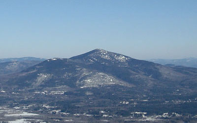
 A subpeak of Kearsarge North Mountain, Bartlett Mountain once featured multiple hiking trails and an alpine ski trail. In addition, there was also a small alpine ski area named the Intervale Ski Slope near the bottom of the CCC ski trail.
Trails on Bartlett Mountain
 Maple Villa Ski Trail - Abandoned
This CCC ski trail went from the Maple Villa Hotel in the Intervale section of Bartlett to Bartlett Mountain. The trail was abandoned sometime in the middle of the twentieth century.
Quotes
| " |
Maple Villa Ski Trail. This trail starts from the highway (N.H. 16, 18 - kept open throughout the year) opposite Maple Villa, between Glen Station and Intervale. It is from 15 to 35 ft. wide and ascends the N.W. slope of Mt. Bartlett to its summit. The drop is approximately 2,000 ft. in 2 1/2 m. Under conditions of a minimum of 8 inches of snow it affords a good run for intermediate and expert skiers on the upper two-thirds of the trail. The lower third is suitable for novices.
|
" |
|
The A.M.C. White Mountain Guide, 1934, p. 256
| |
| " |
In 1933, Emerson, aided by Dodge, Proctor and Carleton, got CCC labor to build the Maple Villa Ski Trail, the first up-to-date trail south of the Notch. This event, the growing popularity of Dodge's camp and the earlier Boston snow trains roused the towns
|
" |
|
Marshall Sprague, 1937
| |
| " |
Maple Villa Trail, E. from State 16 opposite Maple Villa Hotel in Intervale to summit of Bartlett Mt. Length 2.5 m. Max grade 26º. Lower section is gradual but becomes progressively more difficult
|
" |
|
New Hampshire: A Guide to the Granite State, 1938, p.532
| |
| " |
Maple Villa Ski Trail. This trail starts from the highway (NH 16, US 302-open throughout the year) opposite Maple Villa, between Glen Station and Intervale. It ascends the NW slope of Mt. Bartlett to its summit. The drop is approximately 2,000 ft. in 2 1/2 m. It affords a good run for intermediate and expert skiers on the upper two-thirds of the trail. The lower third is suitable for novices.
The Intervale Ski Slope (tow) is located on the E bank of the E Branch 1/4 m. from highway NH 16.
|
" |
|
The A.M.C. White Mountain Guide, 1940
| |
| " |
Maple Villa (New Hampshire Forestry and Recreation Commission). Length 2.5 mi. Class nov., int.
|
" |
|
New Hampshire Winter Map, 1947-48
| |
Images
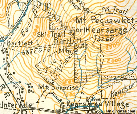
1934 AMC Map of Bartlett Mountain
1940 AMC Map of Bartlett Mountain
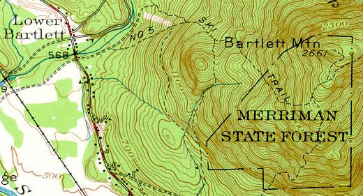
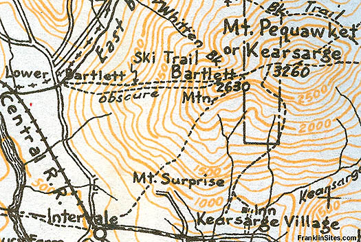
1942 USGS Topographic Map of Bartlett Mountain
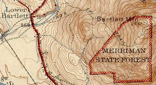
1945 USGS Topographic Map of Bartlett Mountain
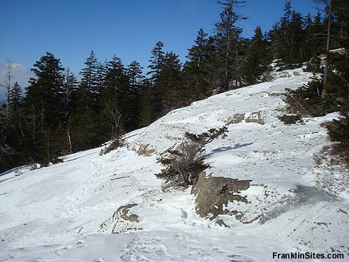
Possible top of Maple Villa Trail (2009)
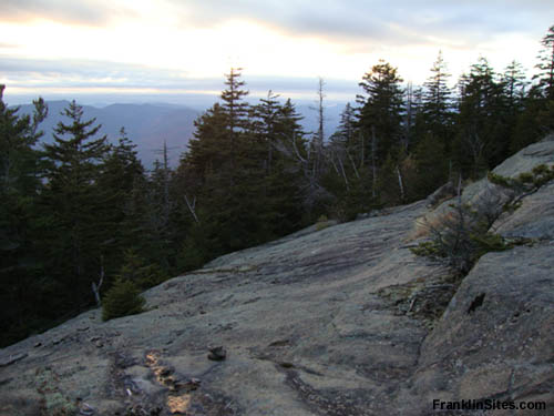
Possible top of Maple Villa Trail (2009)
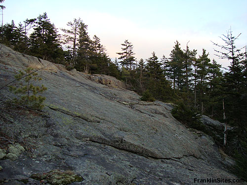
Possible top of Maple Villa Trail (2009)
Resources
New Hampshire: A Guide to the Granite State. Boston, MA: The Riverside Press, 1938.
New Hampshire Winter Map. New York, NY: General Drafting Co., Inc. 1947-48.
Bartlett Mountain - FranklinSites.com Hiking Guide
Intervale Ski Slope - New England Lost Ski Areas Project
Sprague, Marshall. "The Eastern Slope Calls the Skiers" The New York Times. 28 November 1937.
Last updated: December 2, 2010
|
