Connecticut
Maine
Massachusetts
New Hampshire
Rhode Island
Vermont
Want to advertise on NewEnglandSkiHistory.com?
Pico Images
Return to Pico Profile
Pico Vintage Ads
Pico Peak
1953-54 Eastern Ski Map
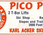
Pico Peak
1954-55 Eastern Ski Map
Pico Peak
1955-56 Eastern Ski Map
Pico Peak
1956-57 Eastern Ski Map
Pico Peak
1959-60 Eastern Ski Map
Pico Peak
1960-61 Eastern Ski Map
Pico Peak
1961-62 Eastern Ski Map
Pico Peak
1962-63 Eastern Ski Map
Pico Peak
1965-66 Eastern Ski Map
Pico Peak
1970-71 Eastern Ski Map
Pico Peak
1971-72 Eastern Ski Map
Pico Peak
1987-88 Eastern Ski Map
Pico Then and Now
Pico
Pico Aerial Imagery, 1994 vs. 2010
See also: Lifts and Maps at
Pico Profile
Advertisement
Topics
Links
What's New
Feedback
Copyright 2002-2024, All Rights Reserved.