NewEnglandSkiHistory.com
CT
|
MA
|
ME
|
NH
|
RI
|
VT
SkiNewEngland.net
 
New Hampshire Cancelled Ski Areas
Mt. Pierce Ski Area
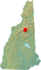
Beans Grant, New Hampshire
Proposed in the 1960s
Mt. Pierce Ski Area location map Overview
Located in the Southern Presidentials, Mt. Pierce is a generally wooded peak with a summit elevation of 4,310 feet. A ski area was rumored to have been proposed for Mt. Pierce in the 1960s.

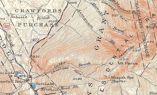
1950 USGS Topographic Map of Mt. Pierce


Today
There are no known remains of the Mt. Pierce Ski Area.

Resources
  • Mt. Pierce - FranklinSites.com Hiking Guide
  • Mount Pierce - Wikipedia


  • Last updated: December 11, 2012
    Also on NewEnglandSkiHistory.com...
    A monorail served ski area?
    A monorail served ski area?
    The only high speed quad area in New England to close
    The only high speed quad area in New England to close
    A classic trail cut by the Civilian Conservation Corps
    A classic trail cut by the Civilian Conservation Corps
    Before the resort, there was the Nose Dive
    Before the resort, there was the Nose Dive
    Will Tenney's lifts spin again?
    Will Tenney's lifts spin again?
    A 5,000 acre resort with a tram and monorail?  Almost.
    A 5,000 acre resort with a tram and monorail? Almost.
       CCC Trails    Cancelled Ski Areas    Expansions    Lifts    Management    Maps    News    Then and Now    Timelines    Topics    In The Press    Links    Site Map    What's New    Feedback

    Copyright 2002-2023, All Rights Reserved.