Connecticut
Maine
Massachusetts
New Hampshire
Rhode Island
Vermont
Want to advertise on NewEnglandSkiHistory.com?
Catamount Images
Return to Catamount Profile
Catamount Vintage Ads
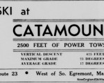
Catamount
January 1, 1941 Berkshire County Eagle
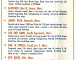
Catamount
February 6, 1953 Berkshire Eagle
Catamount
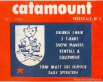
1957-58 Eastern Ski Map
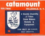
Catamount
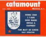
1960-61 Eastern Ski Map
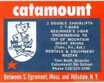
Catamount
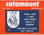
1961-62 Eastern Ski Map
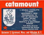
Catamount
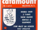
1962-63 Eastern Ski Map
Catamount
1964-65 Eastern Ski Map
Catamount
1965-66 Eastern Ski Map
Catamount
1966-67 Eastern Ski Map
Catamount
1967-68 Eastern Ski Map
Catamount
1970-71 Eastern Ski Map
Catamount
1971-72 Eastern Ski Map
Catamount
1976-77 Eastern Ski Map
Catamount
1995-96 Ski America
Catamount Then and Now
Catamount
Catamount Aerial Imagery, 1994 vs. 2011
See also: Lifts and Maps at
Catamount Profile
Advertisement
Topics
Links
What's New
Feedback
Copyright 2002-2024, All Rights Reserved.