Passadumkeag Mountain
Grand Falls, Maine
Proposed in the 1990s
 Overview
After a proposal to build a ski area on Lead Mountain was rejected, developers set their eyes on nearby Passadumkeag Mountain.
A bit scaled back in comparison to the previous proposal, Ski Passadumkeag Mountain Association President Robin Brooks planned an 800 vertical foot, $2.5 to $5 million ski area.
While some sort of land purchase agreement was signed in late March of 1996, it is thought the proposal fell apart sometime in 1997.
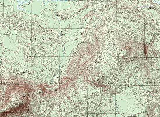
A USGS map of Passadumkeag Mountain
Today
There are no known remains of the Passadumkeag Mountain proposal.
Quotes
| " |
Robin Brooks, president of Ski Passadumkeag Mountain Association, wants to purchase or lease about 500 acres of land on a 1,049-foot peak, which would offer skiers an 800-foot vertical drop.
|
" |
|
Portland Press Herald, 1996
| |
Resources
"Eastern Maine Ski Resort Proposed." Portland Press Herald. 11 Mar. 1996.
Last updated: November 26, 2012
|
|
